GIS Mapping
GIS CD-ROM Page
(If you want a copy of the CD or have any questions about it, check out this
page.)
Juniata Watershed GIS Development
The JCWP GIS data files have been collected and processed from various sources including PennDOT, Army Corps of Engineers, and Pennsylvania Spatial Data Access (PASDA) at Penn State University. The initial stages of processing the information included:
- Researching, identifying and downloading the most recent and best informational coverage.
- Documentation of the Metadata
- Importing Arc\Info files.
- Separating the pertinent county information from statewide coverage.
- Converting the information from various projections to a Latitude-Longitude or appropriate coordinate system.
- Separating the Juniata Watershed region that intersects the corresponding counties.
- Organizing the processed layers into their appropriate categories.
- Creating views and layouts in Arc/View of differing projects relevant to the public meetings and management plan.
As a result of the above processing procedure the information collected for the counties within the Juniata watershed are divided into two basic categories. The first category is countywide. All of the information collected for the seven major counties in the watershed is saved separately for the respective counties. The second category is regional, and contains all information for the Juniata Watershed.
There are many possible layers that could still be incorporated into the GIS system. Future layers under consideration to be created include but are not limited to:
-
Conservation Subdivisions
-
Agricultural Preservation Areas
-
Forest Stewardship Plan lands
-
Dirt and Gravel Road problem areas
- Proposed Development Areas
JCWP Plan Maps
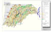
The maps shown below are just a small sampling of the information the Juniata Clean Water Partnership (JCWP) has. Please feel free to contact the JCWP if you have any questions.
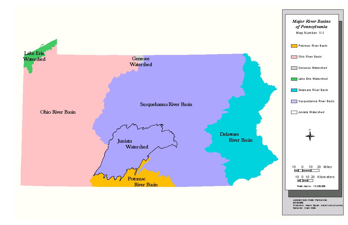
Major River Basins of Pennsylvania
 County Boundaries
 Major
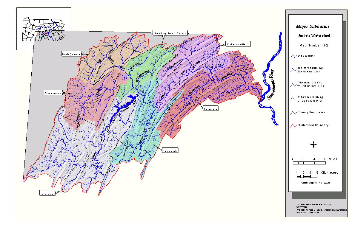
Sub basins within the Juniata Watershed
Major
Sub basins within the Juniata Watershed
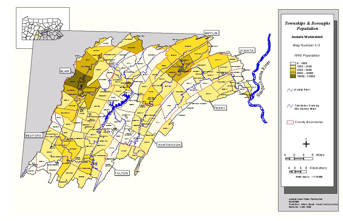 Townships and Boroughs - Population
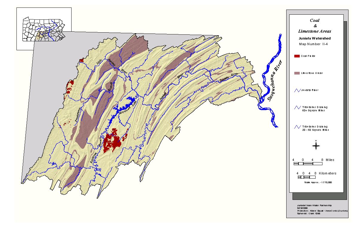
 Geology
 Land Cover (upper half of the Juniata River watershed)
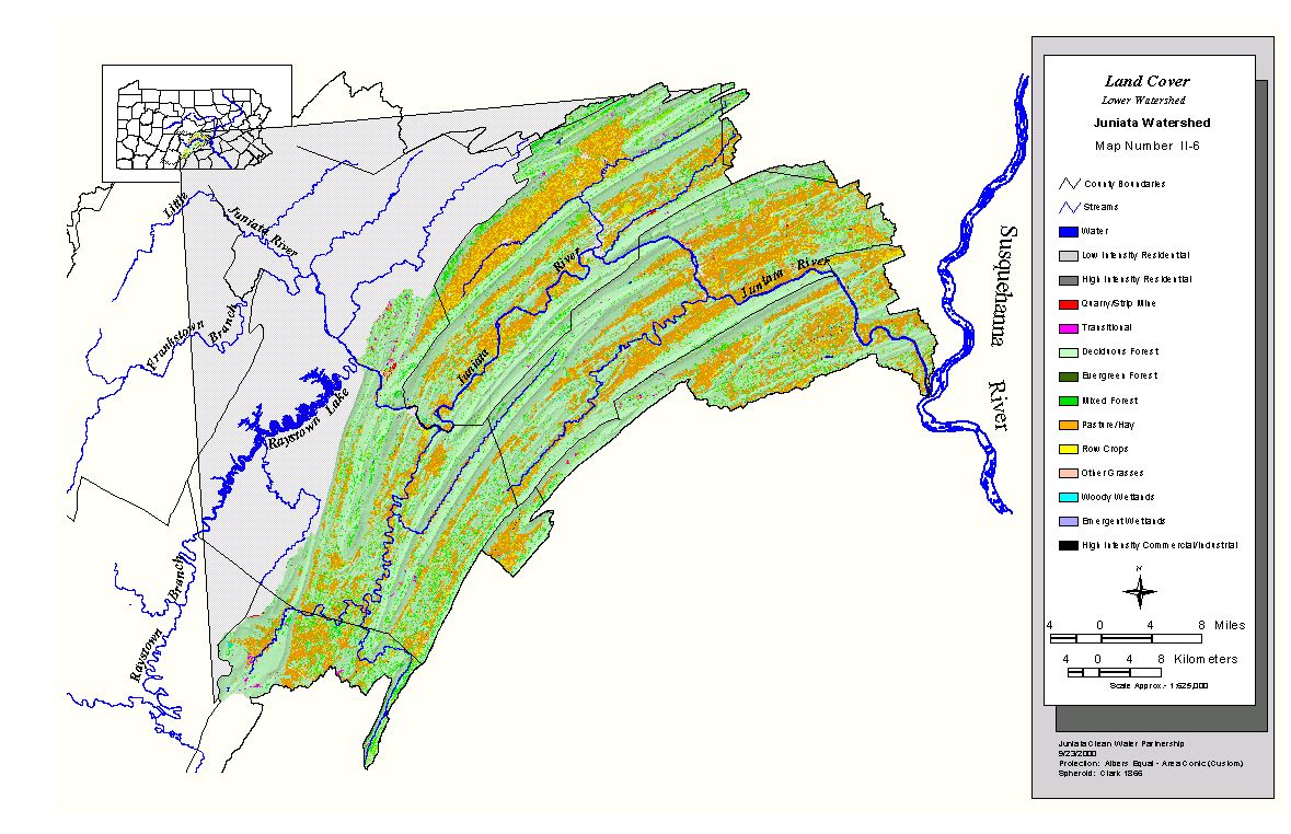
Land Cover (lower half of the Juniata River watershed)
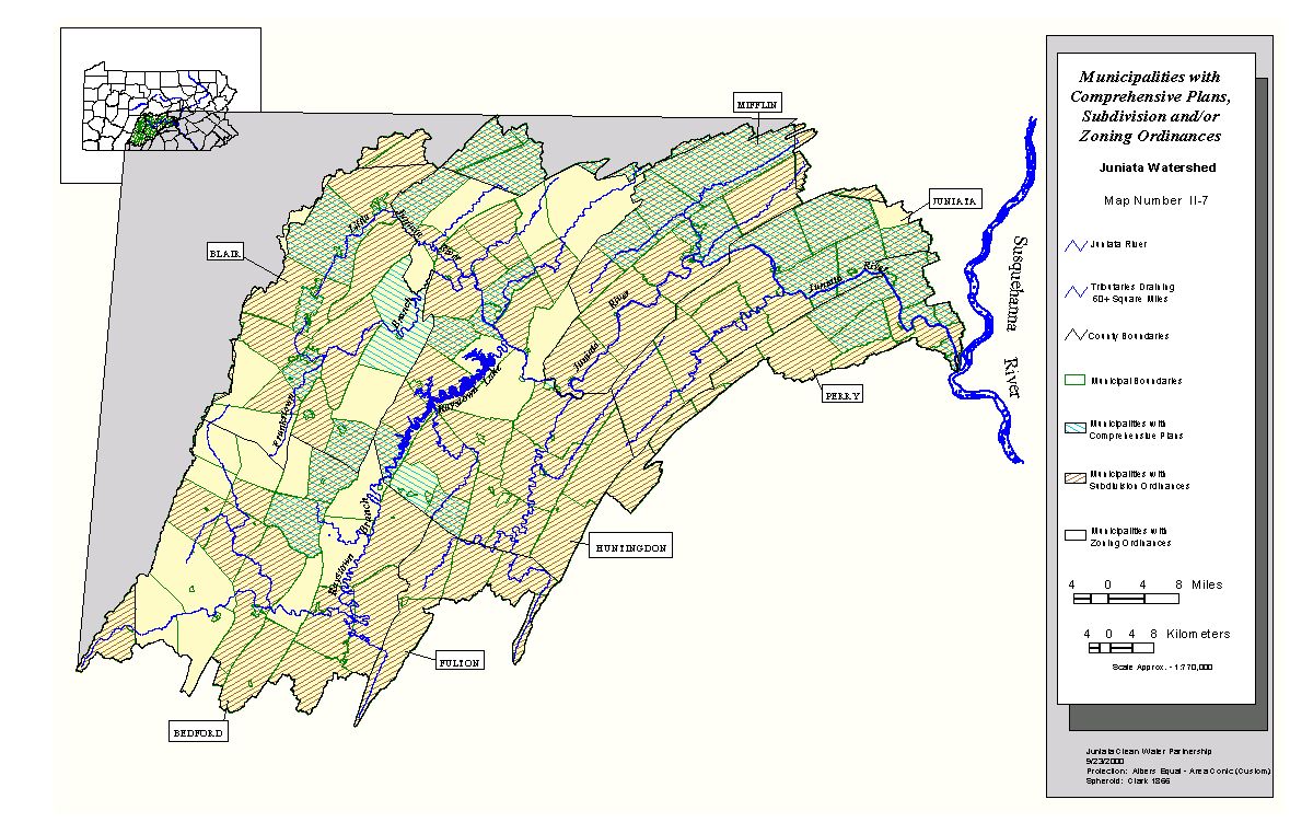
Municipalities with Comprehensive Plans, Subdivision, and/or Zoning Ordinances
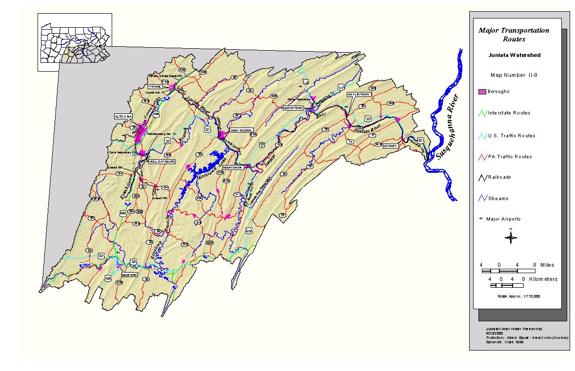 Major Transportation Routes
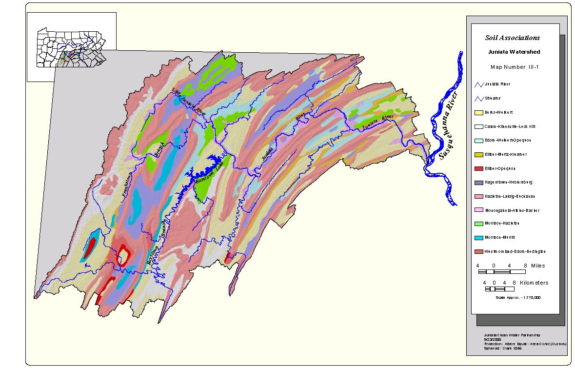 Soils Associations
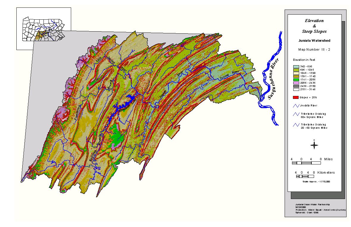 Elevation and Steep Slopes
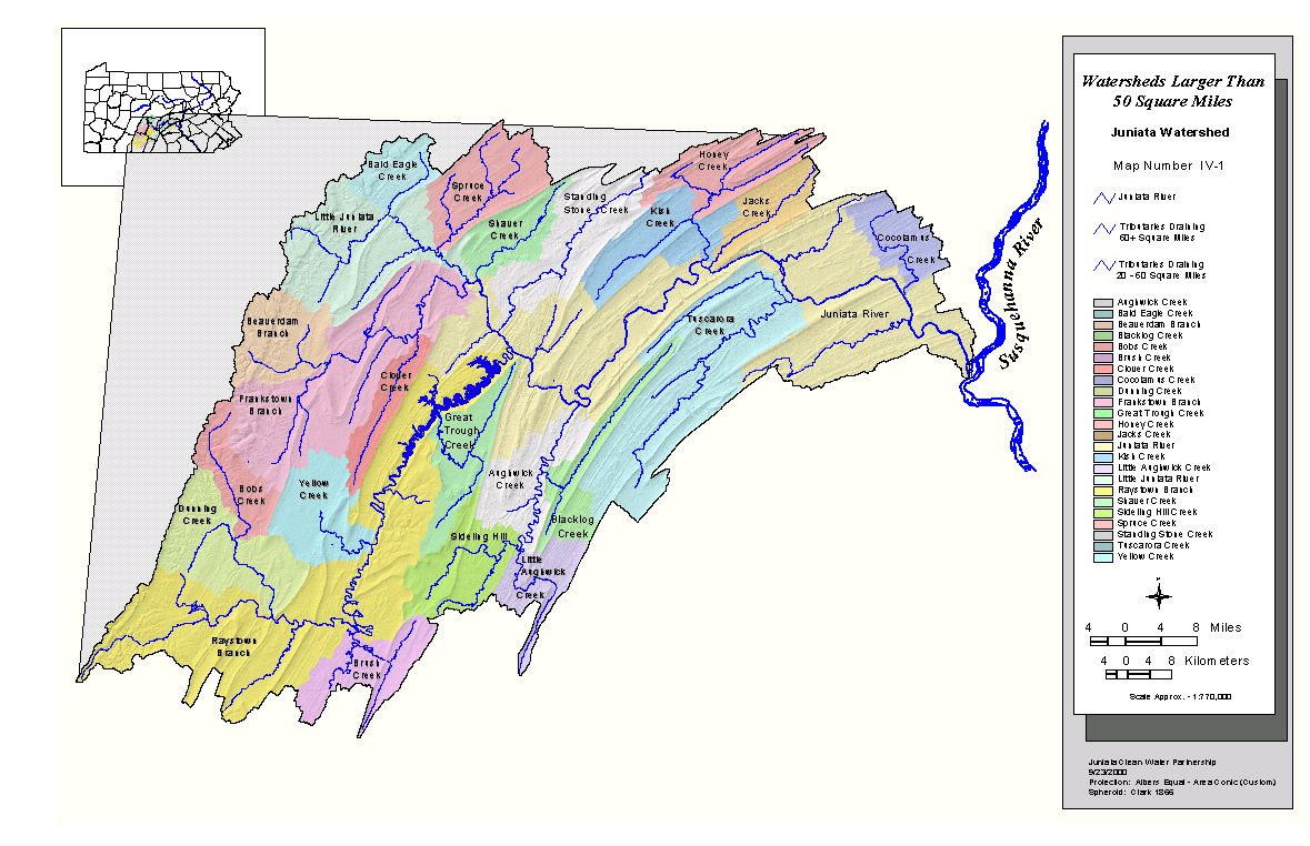 Watersheds Larger Than 50 Square Miles
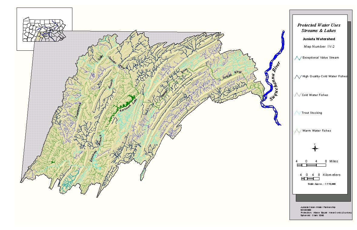 Protected Water Uses - Streams and Lakes
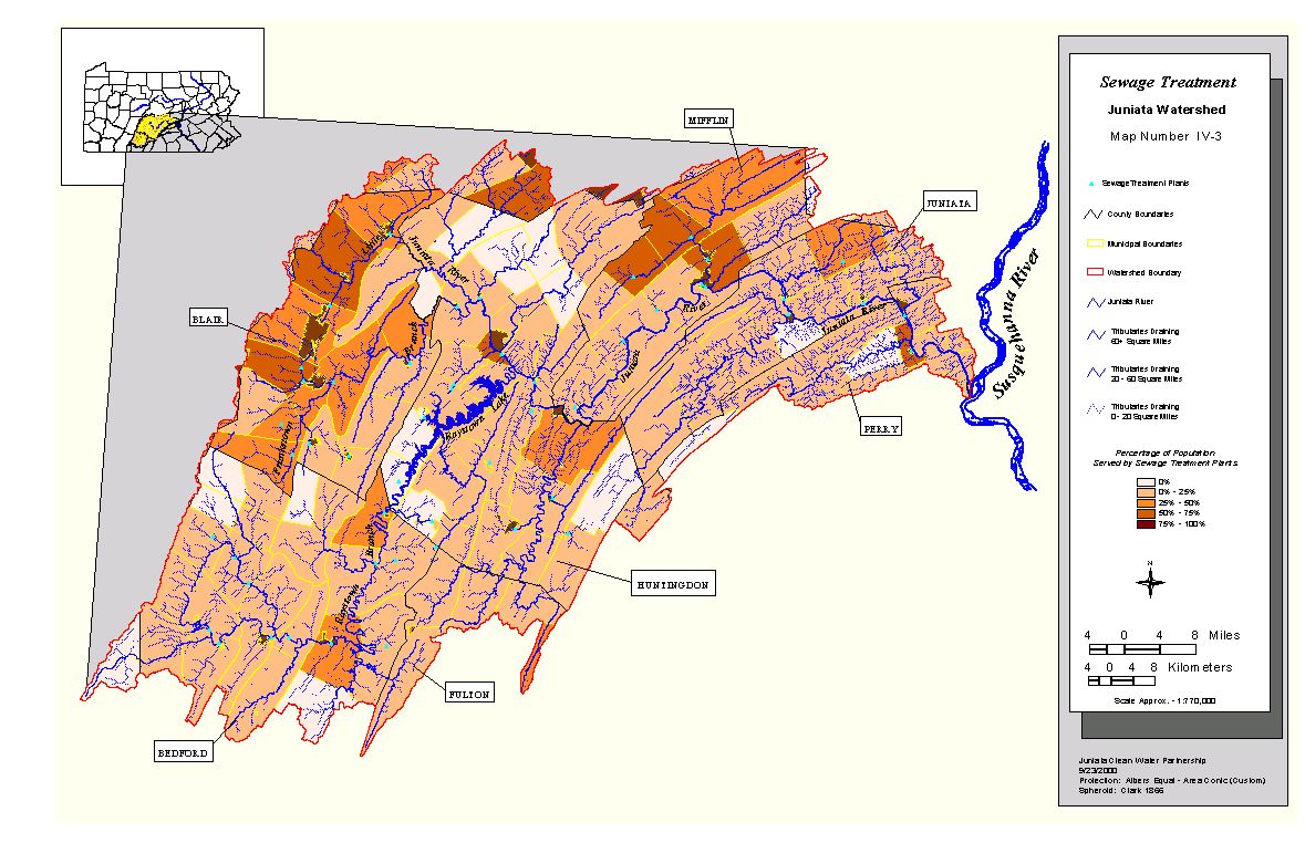 Sewage Treatment
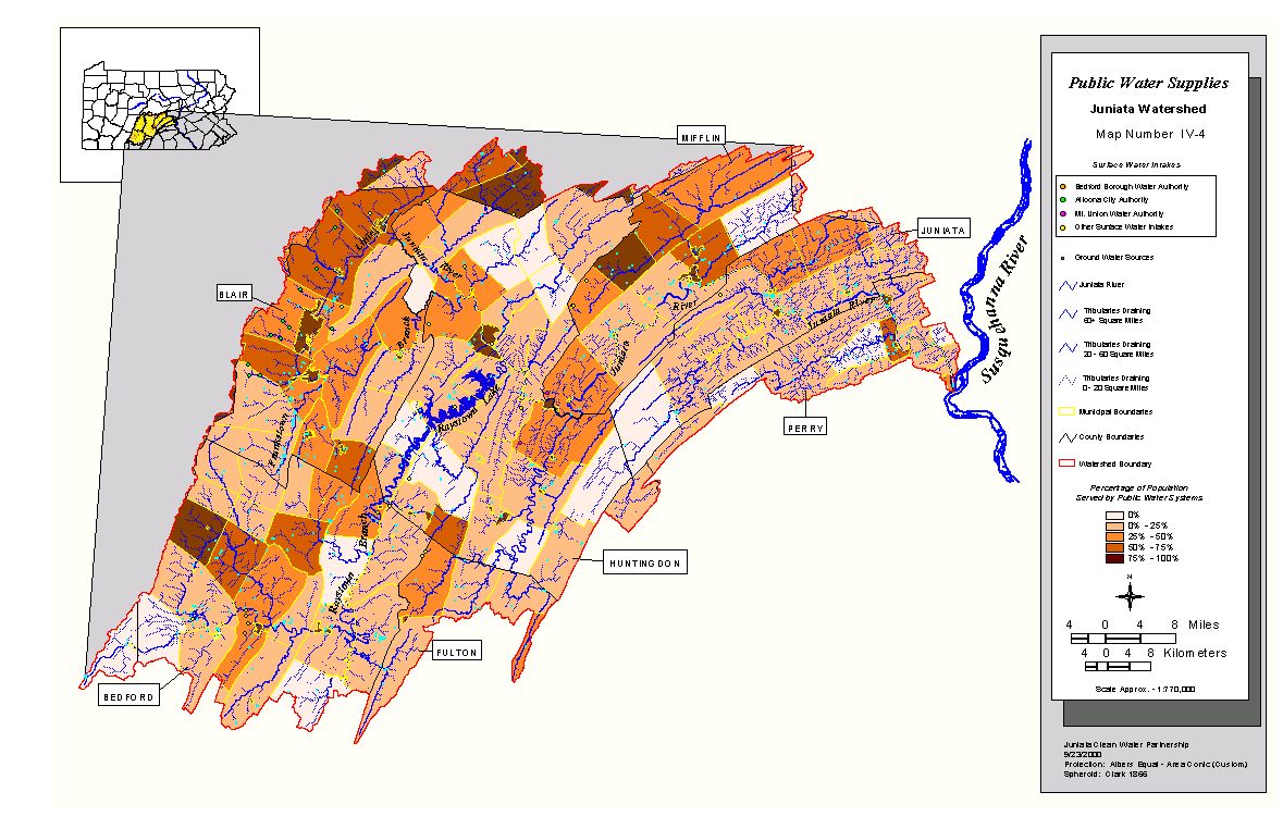 Public Water Supplies
 Recreation Areas